Unearthing the past – using historic maps to locate missing peatland
A new collaboration between The James Hutton Institute and the National Library of Scotland digitises the extent of historic moorland using a combination of AI and 180-year-old maps.
The collaboration, which follows on from a project mapping grassland on peat, has, for the first time, allowed for the classification and localisation of over five million hectares of moorlands as they appear in the first edition Ordnance Survey maps, produced between 1843 and 1882.
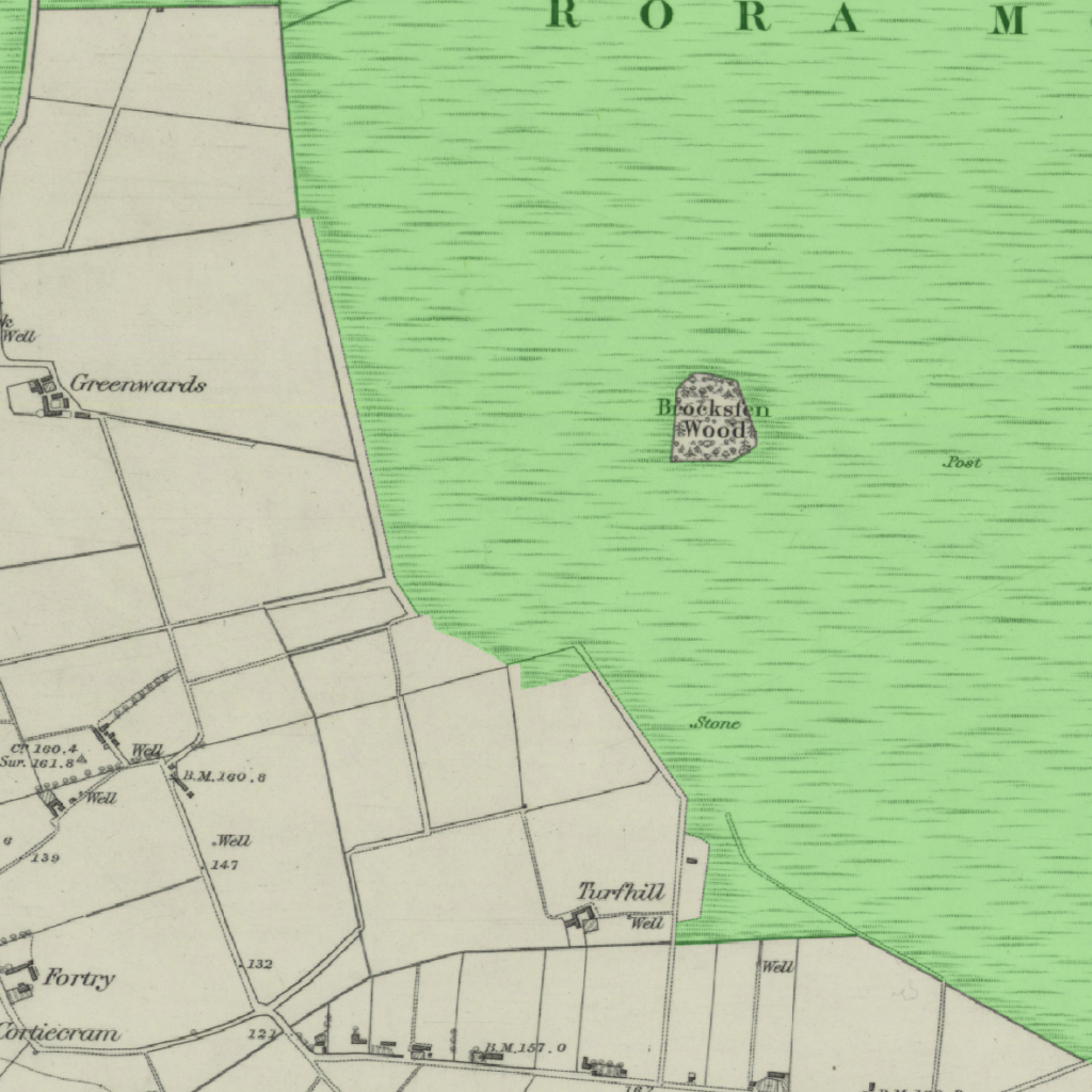
By using a computer vision machine learning model trained to detect the specific symbols on the map, areas of bog, moss and moorland that have often been damaged or, in places, lost entirely in the past 180 years, can now be identified. Researchers hope this will provide an additional method for identifying areas of converted peatlands that contribute a total of 6.34 Mega Tonnes, or 10 – 15 per cent of Scotland’s annual emissions, of CO2 equivalent.
Fraser Macfarlane, Machine Learning Research Scientist at the Hutton, said, “The maps in the collection at the National Library of Scotland are an incredible resource that offer a unique view into the past. The Ordnance Survey is a very reliable source, from which we can extract information from 140 years ago. Understanding that information offers valuable insight and can play a vital part in our research.
“These techniques can be applied to other historic maps, such as the James Hutton Institute collection.”
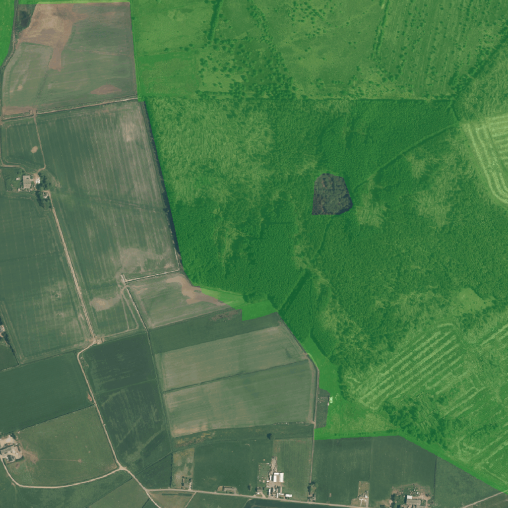
The new digital layer is available using this viewer on the NLS website. The sliders allow users to change the transparency of the produced data and the historic maps to show comparisons with modern satellite imagery. Additionally, users are invited to contribute to the improvement of the dataset using the corrections panel to highlight any areas of missing moorland.
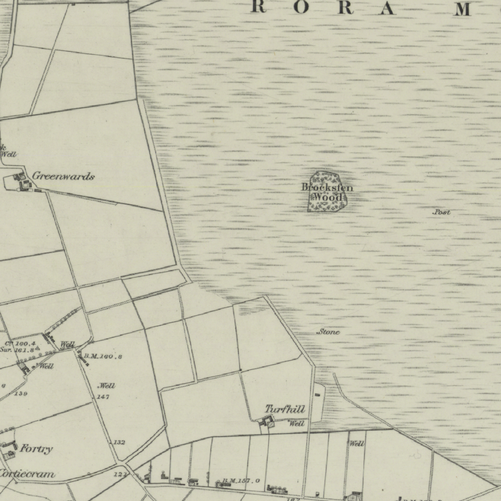
The images below show an example of the type of site this method aims to detect – an upland site in Perthshire with a range of grasses, sedges and land grazed by sheep. It is a mosaic of peat and shallower organic soils.
“The maps in the collection at the National Library of Scotland are an incredible resource that offer a unique view into the past. The Ordnance Survey is a very reliable source, from which we can extract information from 140 years ago.”
Fraser Macfarlane, The James Hutton Institute


Chris Fleet, Map Curator at the National Library of Scotland said “We have been very happy to collaborate with the James Hutton Institute on this useful project to create a new dataset showing moorland on Ordnance Survey 1st Edition six-inch maps of Scotland. As well as showing the exciting potential of Machine Learning technologies, this layer will be of great interest and value to all those interested in historic moorland coverage in Scotland.”
